Scenic Trains
Glacier
Express
Bernina
Express
Golden
Pass Line
Wilhelm
Tell Express
Mont
Blanc - St Bernard
Palm
Express
Excursion Trains
Jungfraujoch
Chocolate
Train
Gornergrat
Matterhorn
Mt
Pilatus Railway
Mt
Rigi Railway
Roches
De Naye
Lucerne Attractions
Lake
Lucerne Cruises
Mt
Pilatus Rail-Aerial
Transport
Museum
Rosengart
Collection
Glacier
Garden
Bourbaki
Panorama
Wagner
Museum
Chronoswiss
Workshop
![]()
LAKE LUCERNE WATER HIKING PATHS
Scenery and Exercise in the Lucerne Regin
Waldstätterweg
Brunnen - Luzern - Rütli
 The
Waldstätterweg is an uninterrupted trail from Brunnen to Rütli via
Lucerne. The Waldstätterweg combined with the Swiss Path, together form
an uninterrupted trail entirely around Lake Lucerne. The 114 kilometer (50 mile)
long Waldstätter Trail is divided into 12 stages of 6-15 km. Depending on
the terrain, each stage is either a moderate hike, a steeper mountain trail or
a walk. The route sometimes comes close to the banks of lake and sometimes traverses
over the backs of mountains. Lucerne
Tourism
The Swiss Path
Altdorf
The Swiss Path is certainly the most well-known circular hiking route
in Switzerland, leading through the historic stops of the Swiss Confederation,
the four lands surrounde Lake Lucerne and Lake Uri which joined to form
a single state. With the 700th anniversary of Switzerland in 1991 (1291-1991),
the 35 kilometer long (17 mile) Swiss Path emerged as a common venture
of all the cantons. It is divided into stages which are partially wheelchair-accessible
as well as accessible by boat (see Lake Lucerne Cuises) or by train.
It begins on the Rütli, the birthplace of Switzerland, leads around
the Urnersee and ends in Brunnen at the Square of Foreign Swiss ("Platz
der Auslandschweizer").
Uri Tourist Info
Follow the Journey of Mary and Percy Shelley to Lucerne Switzerland in Secret Memoirs of Mary Shelley Frankenstein Diaries Audiobook
Reuss River Hike
Lucerne - Emmenbrücke - Perlen
 This
walking trail begins right in the heart of Lucerne, following always
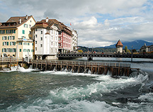
on the left side of the Reuss River, to the "needle" dam, the
wooden spikes where the water levels of the Vierwaldstättersee otherwise
known as Lake Lucerne, are regulated. Just a little way beyond, follow
the narrow path next to the Historical Museum towards the Mill bridge
which was built in 1408 with series of paintings done by Caspar Meglinger
(mentioned in new book Mary
Shelley's Secret Memoirs). Just continue following
the water, partly on the sidewalk, to the Reuss Island with its small
shops
and
offices.
From
here a longer
section
of
the trail will trace right next to the river. Near the railroad track
climb up some steps and cross over the Kleine Emme River at the same
height as the bridge. It is from here, on the other side of the Emme
you can take the Planet hike to Perlen. Or you can also take the bus
No. 2 from Emmenbrücke back to Lucerne. Those who continue on to
Perlen can catch bus no. 22 back to Luzern. The walk as far as Emmenbrücke
is about 1 hour 30 minutes, the whole route to Perlen is 3 hours. Take
a snack in a backpack, or you can easily find a number of restaurants
near the hiking trail.
Lucerne Tourism
Emmen River Path
Sörenberg–Emmenbrücke
The Emmenuferweg offers the scenic landscape of the canton of Lucerne.
What is particularly convenient is that this route leads directly to
all the train stops of the Lucerne-Schüpfheim rail line, so that
you can to visit any of the sections individually. On walks along the
Kleine Emme, alpine creek, there is a lot to see and with every new turn
along the stream the waters change sound a little bit different with
the terrain. The full Emmenuferweg is 54 kilometers, but you can get
on or off the train and walk only the distance you can manage.
UNESCO
Biosphäre Entlebuch
Meadow Trail
Steinen
Alpine meadows are one of the most endangered ecosystems in Europe. The
flood plain is constantly shifting between high water and low water and
provides an important habitat for many endangered plants and animals.
The meadow landscape is brought up close to the visitor by information
boards on the 700 meter long "Auenspur" (meadow trail) in the
estuary area of the Steineraa. In the Steiner flood plain, there are
almost 40 wooded plant varieties signposted.
Steinen Tourism
From Andermatt
Four Lake High Altitude Hike
Melchsee-Frutt - Engelberg (Trübsee)
The Four Lake High Altitude Hike is one of the most beautiful hiking
routes in Switzerland. The starting point is the aerial cable station
at Melchsee-Frutt.
The trail route runs along the picturesque Melchsee up to the crisp turquoise
Tannensee, and then drops down via Tannalp to the deep-blue Engstlensee.
The Engstlenalp is also a powerhouse and is excellent for a picnic. Via
Jochpass, the path then heads down the other side of the mountain to
the glassy Trübsee and then continues further on to Engelberg.
Sportbahnen - Melchsee-Frutt
The Four Rivers Source Route
Andermatt
In this region of the Switzerland Alps, the European divide, can be found
the sources of four of Europe’s great rivers which flow in different
directions to Germany, France and Italy – the Rhine, the Rhone,
Reuss, and Ticino rivers. These four sources can be reached by well-developed
hiking paths in the high mountain region, ideal for individual day hikes.
At the start and end points of the each of these hikes, there are stops
for public transportation. If you want to reach the source of all four,
plan a five-day hike with a number of good overnight-stay opportunities.
Andermatt Gotthard Tourism
Schöllenen Loop Road
Andermatt
 The path way over the high Gotthard Pass leads through the dangerous
Schöllenen ravine with steeply rising walls above the wild rushing
river. The inhabitants of the Urseren Valley hand built steps, footbridges
and paths they only needed help to build a bridge according to the legend.
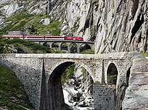
The starting point of the 560 meter (500 yards) loop road is the car
park above the two Devil's Bridges (Teufelsbrücken). After crossing
the old Devil's Bridge on Kommerzialstrasse, which dates back to 1830,
you come through the old military tunnel to the eastern side of the Schöllenen
Gorge, which presents an breath-taking view into the canyon and of the
twin Devil's Bridges. The loop route leads up a short rise to the meeting
point. The pathway continues on over the bridge at the level crossing
of the Matterhorn-Gotthard-Bahn (MGB) railway(see Matterhorn Gotthard
bahn) to the bank of the roaring Reuss River. Then via the undercrossing
of the viaduct you arrive back at the starting point.
Andermatt Gotthard
Tourism
Hallwilersee Circle Route
Mosen - Mosen
This casual route around the shore lands of the largely unspoiled Hallwilersee
presents some exciting highlights such as the Hallwil Castle or a stilt
house, as well as possibilities for refreshing swimming breaks. The walk
begins in Mosen at the south end of the Hallwilersee lake. Thanks to
the environmental protection zone, the banks have remained undeveloped
and provide hikers with an ideal local recreational area with the intact
flora and fauna of the Seetal. The walk takes about 5 hours, leading
almost entirely along the banks of the lake. Boat stops on the lake enable
a shorter walk.
Lenzburg Seetal Tourism
Route on the Water Nature Path
Schötz
On the casual moderate nature information path along the Wigger River,
nature enthusiasts can follow information boards explaining the diverse
habitat where fish, invertebrates, insects and reptiles live in the species-rich
mountain meadow stream. A detailed brochure with a map can be gotten
from the town hall in Schötz village. Arrival is best by train to
Nebikon, with the path on foot to the . first information board around
500 meters south of the "Brun-Mech AG" machine factory in Nebikon.
The end of the "Route on the Water" path is near the junction
of the Rot River with the Wigger. The return to the Nebikon rail station
by foot is about another 50 min, the whole route about 2 hours.
Verkehrsbüro
Willisau
Find best travel and hotel deals in Lucerne on TripAdvisor
